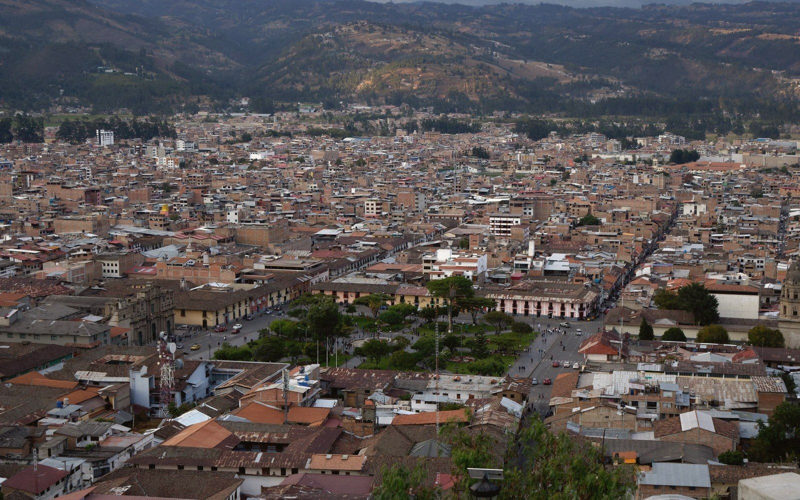
In 1573, the Spanish Crown issued a set of ordinances so thorough that they specified the width of streets, the orientation of blocks, the exact dimensions of the central plaza and even which way the main church should face. These were the Laws of the Indies — Leyes de Indias — and for roughly two centuries they functioned as a blueprint for urban construction across an enormous territorial range, from northern Mexico to southern Chile. What they produced was not one city but a type: a rectilinear grid anchored by a large open square, the plaza mayor, from which streets ran outward in parallel lines to the edge of settlement.
The model was not purely invented. It drew on Renaissance planning theory, on the Roman castrum, and on a handful of earlier Spanish colonial towns in the Caribbean. But the 1573 ordinances codified it, and Spanish colonial administrators applied it with remarkable consistency. Mexico City, Lima, Bogotá, Buenos Aires, Santiago — each arrived at roughly the same solution: square blocks of roughly equal size, a central plaza flanked by the cathedral, the cabildo (town council) and, usually, a commercial arcade. Orientation ideally aligned with the cardinal points, so that no street would receive too much or too little sun.
The result, seen on any aerial photograph, is unmistakable. The Spanish colonial city reads as a pattern — regular, legible and, from certain angles, oppressively tidy.
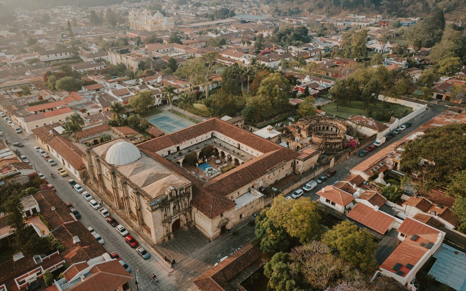
The interest begins where the pattern fails.
Topography was the most immediate obstacle. Quito, sitting at nearly 2,800 metres on a narrow Andean ridge, could not produce anything like a flat, square city. The grid exists in its historic centre — the UNESCO inscription of 1978 recognised it as one of the best-preserved colonial urban cores in the Americas — but it bends and tilts as the land dictates. Streets climb so steeply that several are half-staircase. The plaza mayor is level, but the city behind it is not, and the ordinances' clean theory collides with basalt.
Cartagena, on the Colombian Caribbean coast, presents a different kind of exception. Much of its historic centre does follow the colonial grid, but the pressure of fortification changed the city's logic. The walls — built across more than a century in response to repeated pirate attack and the capture and ransoming of the city by Francis Drake in 1586 — imposed a military geometry over the civil one. The city became its own enclosure, and streets near the walls responded to the bastions rather than to any theoretical ideal.
Then there is the pre-colonial exception: Cusco. When the Spanish refounded the Inca capital after 1534, they attempted to impose a grid over a city whose sacred geography was already deeply structured. The ceque system — a radiating pattern of ritual lines from the Coricancha temple — organised Inca Cusco in ways wholly alien to the Laws of the Indies. The result was not a clean replacement but a layering. Inca stone walls became the foundations and lower courses of Spanish colonial buildings. The colonial grid pressed down onto a radial structure beneath it, and the two have never entirely separated. Walking certain streets in Cusco today, you move along walls that are simultaneously two cities.
Buenos Aires offers a different lesson: what happens when the grid succeeds almost completely. The plan there was so relentlessly applied, and the terrain so flat, that the city eventually became its own critique — a monotonous extension of identical blocks that, as the city expanded in the nineteenth and early twentieth centuries, produced neighbourhoods of exceptional sameness. The Argentine writer Jorge Luis Borges described his city as infinite and, in certain moods, featureless. The grid's victory here is also the grid's failure: legibility without surprise.
The colonial grid was not a bad idea applied badly; it was a powerful instrument applied to wildly varying conditions. Where it worked smoothly — flat land, no prior urban structure, no pressing military need — it produced functional, coherent cities that still organise daily life in recognisable ways. Where it met resistance, the friction left traces that are now among the most architecturally and historically interesting parts of those cities.
Exceptions do not disprove the rule. They reveal its shape.